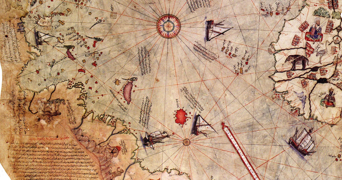
The Piri Reis map, an age-old cartographic mystery, has fascinated researchers for centuries with its uncanny details and enigmatic origins. Seen as a conundrum of early cartography, it offers a unique perspective into the worldview of the 16th-century explorers. Steeped in intrigue, this historical artefact continues to inspire questions about the extent of geographical knowledge in a time thought to be less informed.
Who is Piri Reis?
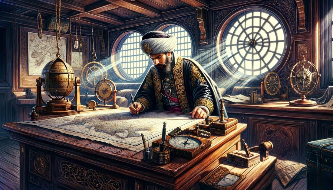
Piri Reis, born as Ahmed Muhiddin Piri, was a distinguished Ottoman Admiral, geographer, and cartographer of the 16th century, best known for his enduring contribution to the world of cartography. His life, no less intriguing than his famed map, speaks of bravery, intellectual pursuits, and unquenchable curiosity about the world.
Born around 1470 in Gallipoli, a strategic naval town on the Dardanelles, Piri Reis was exposed to maritime life from a young age. His uncle, Kemal Reis, was a famous corsair who not only made a name for himself in naval battles but also left an indelible imprint on young Piri’s life. Following in the footsteps of his uncle, Piri Reis started his maritime career as a corsair, a privateer or pirate working on behalf of a nation.
The early years of his seafaring life were marked by a series of notable events, one of which was his uncle’s capture of Spanish vessels. The loot was not only gold or goods but also precious navigational maps and charts that later played a significant role in shaping Piri Reis’ cartographic work.
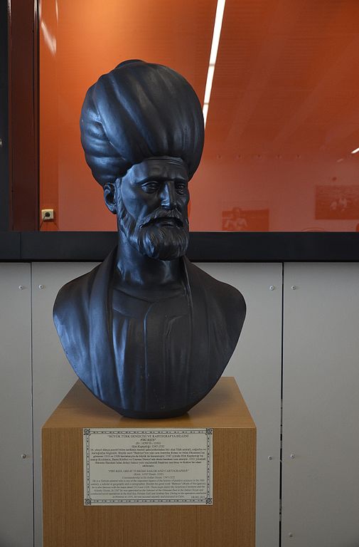
Piri Reis was a dedicated student of geography and navigation. During his maritime adventures, he meticulously collected a wealth of geographical knowledge and naval charts, both from his journeys and those captured by others. This love for knowledge acquisition led him to take a scholarly turn in his later life.
From corsair to cartographer, his transition was marked by the creation of his famous world map in 1513. The map was part of his ambitious project, the Kitab-ı Bahriye (Book of Navigation), a significant maritime guide of the era. It encompassed detailed information about the Mediterranean Sea’s many ports, bays, and coastal strips, becoming an invaluable resource for seafarers.
However, Piri Reis’ fate was not without its share of adversity. Despite his numerous contributions, he fell out of favor with the Ottoman court and was beheaded in 1553. His life, while controversial, is undeniably an inspiring saga of intellectual pursuit, naval expertise, and unwavering curiosity about the world beyond the known horizons. His legacy continues to live on in the eponymous map, a fascinating cartographic mystery that continues to pique the curiosity of researchers worldwide.
The Piri Reis Map
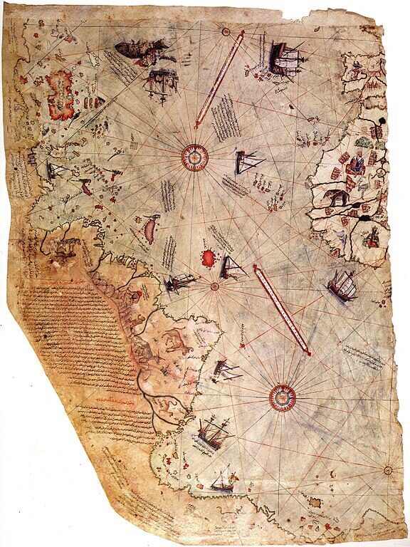
The Piri Reis map, an extraordinary artifact dating back to the early 16th century, has both puzzled and intrigued scholars with its incredible detail and mysterious origins. Composed by Piri Reis himself in 1513, the map measures approximately 90cm by 65cm and is a partial representation of the world as it was known then. Crafted on gazelle skin parchment, the map stands as a testament to the early mastery of cartography.
The map’s sources are what adds to its intrigue. In Piri Reis’s notes written on the map, he revealed that it was drawn from about twenty different sources, a significant number of which were charts captured from Spanish ships during naval raids. These charts held invaluable geographical knowledge, including some reputed to be from the voyages of Christopher Columbus, hence providing details of the newly discovered Americas.
However, what significantly increases the map’s mystery quotient is the claim that some of these source maps were traced back to the famed Library of Alexandria. As the largest and most significant library of the ancient world, it contained a wealth of geographical knowledge, including maps from notable Greek scholars. If this is indeed true, it would mean that the Piri Reis map holds within it ancient geographical wisdom thought to have been lost with the burning of the library.
In essence, the Piri Reis map is not just a cartographic representation of the world but also an encapsulation of the seafaring knowledge of various eras. It’s a unique amalgamation of cartographic data from various sources and eras, stitched together with remarkable precision and artistry, that continues to awe and mystify scholars to this day.
An In-Depth Analysis of the Piri Reis Map
At first glance, the Piri Reis map displays an intriguing depiction of the known world in the early 16th century. However, upon closer inspection, it reveals anomalies that have baffled historians, geographers, and conspiracy theorists alike for centuries.
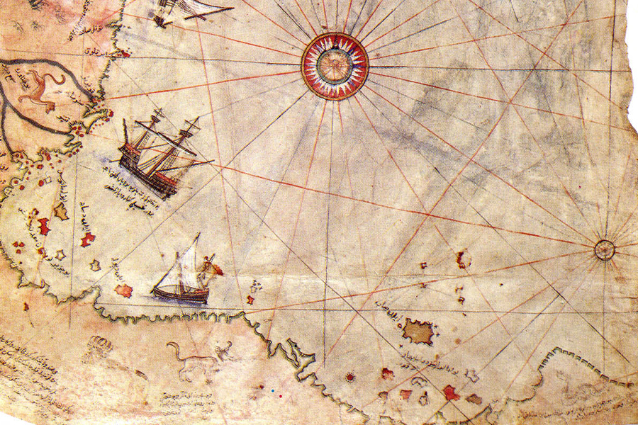
One of the most startling features of the map is its depiction of Antarctica. Not officially discovered until 1772, and certainly not fully explored in the 16th century, the continent’s appearance on a map from 1513 raises fascinating questions. The map not only depicts Antarctica but also shows it as a landmass free from ice, a condition speculated by modern scientists to have last occurred around 6000 BC. This oddity has ignited myriad theories, some more grounded in science than others.
Certain fringe theories suggest the involvement of advanced ancient civilizations or even extraterrestrial interference. However, these hypotheses, while captivating, lack credible evidence and are generally dismissed by the academic community.
Returning to a more grounded perspective, the map’s representation of South America is also intriguing. The map provides a detailed portrayal of the Brazilian coast, extending southwards to what appears to be the northernmost fringes of Antarctica. Remarkably, the Andean mountain range, not officially recorded until 1533, is prominently featured, suggesting that Piri Reis had access to geographical data not yet widely known in his time.
Moreover, the map curiously features the Shetland Islands, officially recorded only in 1603, almost a century after the map’s creation. The islands, found to the north of Scotland, are depicted with a reasonable degree of accuracy, which again, signals that Piri Reis had sources that predated mainstream geographical knowledge of the era.
This begs the question: how did Piri Reis come into the possession of such detailed and advanced knowledge? Given his extensive connections in the maritime world and the fact that he used charts captured from Spanish ships, it’s plausible that he had access to navigational data that wasn’t widely known or officially recorded. It’s also conceivable that some of the charts originated from explorations not officially acknowledged or that have been lost in the annals of history.
Furthermore, it’s worth noting that although the map contains puzzlingly advanced knowledge for its time, it’s not without errors. Some geographical features are misrepresented or exaggerated, which aligns with the view that Piri Reis worked with sources from different periods, leading to a blend of accurate and distorted information.
Charles Hapgood and the ‘Maps of the Ancient Sea Kings’
Charles Hapgood, a respected American college professor and author, dedicated a significant part of his academic research to the intriguing anomalies of the Piri Reis map. As a history professor at Keene State College in New Hampshire, he ventured into the realms of ancient cartography, challenging conventional understanding with his revolutionary ideas.
His most acclaimed work, ‘Maps of the Ancient Sea Kings’, published in 1966, presented groundbreaking theories about the Piri Reis map and other similar ancient maps. Hapgood argued that these maps were evidence of an advanced global civilization that existed thousands of years before known history, which he believed had the capability of sophisticated navigation and cartography.

One of Hapgood’s most intriguing propositions was the theory of Earth crust displacement, which he believed could explain the map’s depiction of an ice-free Antarctica. According to him, the Earth’s crust could shift, displacing continents and drastically changing the planet’s geography over time. He theorized that the last such shift occurred approximately 12,000 years ago, thereby aligning with the hypothesis of an ice-free Antarctica as shown in the map.
Moreover, Hapgood contended that the civilization responsible for the advanced cartography was none other than the legendary Atlantis. According to him, the survivors of Atlantis, after a cataclysmic event, had spread their geographical knowledge across different cultures, eventually contributing to maps like the one created by Piri Reis.
It’s essential to note that Hapgood’s theories were meticulously researched. Working with his students, he performed a detailed comparative analysis of the Piri Reis map with modern-day maps, leading to his extraordinary hypotheses. His work involved careful redrawing and rectification of the maps based on his proposed global shifts, showing alignments with the modern globe.
Despite his well-researched arguments, Hapgood’s theories were met with mixed reception. While they challenged conventional historical and geological understandings and remained controversial, his work undoubtedly added a fascinating dimension to the study of the Piri Reis map.
In the realm of scholarly pursuits, Charles Hapgood’s theories represent the essence of academia – the courage to question established knowledge and explore the boundaries of the unknown. His investigation into the Piri Reis map, regardless of its acceptance, continues to intrigue and inspire researchers worldwide.
Unraveling the Enigma: A Final Thought
In conclusion, the Piri Reis map is a beguiling piece of history that continues to perplex and fascinate. Its inexplicably advanced geographical details, its mysterious sources, and the questions it raises about ancient civilizations lend it an enduring allure. The map not only charts the known world of the 16th century but also navigates the vast oceans of uncertainty and speculation. Despite numerous studies and theories, the true extent of its enigma remains uncharted. As we delve into its intricate lines and symbols, we continue our voyage into the realm of the unknown, sailing ever closer to the distant horizon of understanding.
Historical Challenge: Can You Conquer the Past?
Answer more than 18 questions correctly, and you will win a copy of History Chronicles Magazine Vol 1! Take our interactive history quiz now and put your knowledge to the test!

